
Fire trucks are a pivotal part of emergency services, and understanding how they can be tracked is imperative for both enthusiasts and professionals in the field. As technology advances, many fire departments are equipped with GPS tracking systems that allow for real-time monitoring of vehicles. This ensures that the closest and most suitable fire truck responds to emergencies efficiently. From understanding GPS technologies to optimizing dispatch protocols, and exploring their operational advantages, this exploration will equip aspiring firefighters and professionals with a comprehensive view of how tracking can save lives and improve service delivery. Each chapter delves into a specific aspect of tracking fire trucks, demonstrating its significance in modern firefighting.
Tracking the Line: GPS Technologies that Make Fire Trucks Faster and Smarter
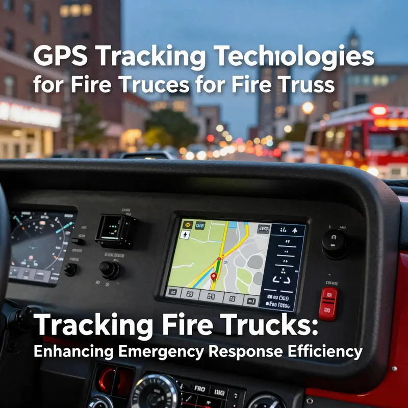
GPS tracking technologies have moved from a nice-to-have capability to a central nervous system for modern fire services. Real-time location feeds, when fused with dispatch workflows, transform how incidents are approached, how resources are shared, and how crews are deployed. The essence is simple, yet powerful: knowing where every unit stands at every moment allows the system to bend toward speed, accuracy, and safety. This is not merely about seeing a blue dot on a map; it is about translating raw coordinates into actionable judgments under pressure. The most enduring gains come when tracking is embedded into a broader discipline of incident command that treats the fire truck as a responsive asset rather than a static tool. The chapter that follows explains how GPS-enabled maps and radio backbones, supported by satellite positioning, have become a practical backbone for nearly every advanced department. It is a story about timing, coordination, and the subtle art of getting the right truck to the right place at the right time.
At the operational heart of GPS-based tracking lies the triad of position, velocity, and status. Fire trucks transmit their precise location and movement through secure networks to a central dashboard where operators monitor many units at once. This real-time visibility creates a shared situational awareness that previously depended on radio chatter and secondhand reports. The data is not only about where a vehicle is; it is about where it is going, how fast it can traverse the current segment of road, and whether it has the fuel and hydraulics to sustain a long response. In practice, dispatch centers layer this information onto digital maps that combine live traffic feeds with road geometry to forecast travel times and detect potential bottlenecks. The result is a more flexible and resilient response profile, one that can adjust flow as conditions evolve from the moment the alarm is sounded.
Historical precedents illustrate the value clearly. In major cities, responders have adopted a practice of rerouting units mid-journey when new data suggests a faster path becomes available. A widely cited example dates back to 2006 when a municipal fleet in a large East Asian metropolis began using fleet-wide GPS to steer units along routes that avoided evolving congestion patterns. The effect was a measurable drop in average response times, not because crews moved faster in a vacuum, but because the system learned to trade raw speed for reliable speed over diverse stretches of urban terrain. The dispatch console, once a simple doorway to a map, became a dynamic command post where travel time estimates were updated in seconds as traffic conditions shifted. In that sense, GPS tracking matured from a navigation aid into a strategic tool that aligns deployment with real-time road realities.
Beyond location and routing, the scope of GPS-enabled tracking extends into fleet management and operational optimization. Core functionalities include precise vehicle location, optimized navigation, multi-vehicle fleet tracking for coordinated responses, and automated dispatching that reduces human error. When these functions are embedded in a broader geographic information system, the department gains a powerful platform for spatial analysis: which stations should support which neighborhoods, how to allocate aerial versus ground resources, and how to anticipate periods of high demand. The combination of GPS with GIS and robust communication networks yields a layered capability: you get not only where the truck is but how its path intersects with weather, terrain, infrastructure, and incident history. In practice, this means dispatchers can orchestrate a more orderly, faster, and safer response by turning data streams into disciplined, repeatable actions rather than ad hoc decisions.
Another layer of sophistication comes from telematics. Modern fleets broadcast more than location; they report engine status, fuel levels, tire temperatures, brake wear, and even sensor data from on-board diagnostics. This telemetry supports fleet maintenance and readiness as a routine part of incident planning. It allows crews to present a credible service plan to the incident commander, not merely a hazy expectation that a vehicle will arrive “soon.” By seeing fuel gauges dip in a predicted pattern during a round of incidents, maintenance teams can schedule refueling or modular swaps before a problem arises, reducing the risk of an unscheduled delay. When a truck’s engine or hydraulic system indicates a potential fault, the system can flag it automatically to a central maintenance team and even reroute assignments to shunt in another unit, maintaining service levels without sacrificing safety. The result is a fleet that is not only fast on the map but reliable in the field, with every component aligned to the demands of continuous emergency coverage.
As departments gauge different incident profiles, they also recognize that not all vehicles serve the same role. A city may rely on aerial ladder trucks to reach high façades, while rural districts lean on off-road engines capable of traversing uneven terrain. A 2026 guidance document, built on cumulative experience, suggests urban areas will prioritize ladder-equipped units for high-rise or industrial exposures, whereas rural environments emphasize mobility and durability. GPS tracking fits neatly into this planning, offering a platform where equipment type, geographic risk, and seasonal workload converge in a single analytic lens. In practice, that means a dispatcher can anticipate the right mix of units for a shift, not by guesswork but by the same data-driven logic that governs modern logistics in other sectors. The same digital framework that tracks location and status can weigh soil moisture patterns, weather forecasts, and historical call loads to shape the recommended fleet composition for a given day or place.
Operational efficiency emerges from the interplay of proximity, time, and reliability. If a squad reports being two minutes closer to a site but has to wrestle through a mile of stop-and-go traffic while another unit faces a five-minute delay due to a closed bridge, the closest unit is not always the fastest choice. This is where the analytic nuance described in recent studies matters: accounting for stochastic driving times and correlations between routes yields better predictions of arrival times and better dispatch decisions. In other words, if you allow for the fact that weather, accidents, and road works can couple driving times between nearby routes, you avoid systematic misjudgments that propagate through the chain of events from alarm to arrival. The practical upshot is more reliable service, especially during peak demand or in densely built environments where small timing differences cascade into longer overall response intervals.
Technology does not replace judgment; it augments it. Real-time GPS data feeds into a dispatcher’s decision-support toolkit that blends mechanical speed with human expertise. In this integration, the dispatch center does not simply select the nearest truck; it weighs the anticipated travel time, the unit’s current readiness, the type of incident, and the need for staging space near the scene. The result is a dispatch pattern that demonstrates both speed and resilience, especially when unusual events occur, such as the sudden need to reallocate resources after a second alarm at the same incident or the arrival of a specialist crew that must join an evolving operation. The discipline of continuous improvement emerges as elsefalls and close calls feed back into the system, refining route models, updating response templates, and reducing the cognitive load on operators during high-stress moments. In short, GPS-enabled tracking is less about tracking a single dot than about orchestrating a network of moving parts into a coherent, adaptive response.
Behind these practical gains lies a research ecosystem that treats emergency response as a complex, dynamic environment. The work that connects GPS data to decision-making for dispatch has pointed to several important insights. First, real-time position data, when coupled with live traffic streams and road geometry, enables route optimization that adapts to congestion patterns as they unfold. Second, the value of monitoring multiple units lies not only in their location but in understanding their status and readiness, which informs how to reallocate a resource without compromising coverage. Third, the integration with telematics supports preventive maintenance and reliability, reducing the risk that an otherwise fast response is hampered by a preventable mechanical issue. Finally, the literature emphasizes that a disciplined approach to data governance and security is essential for ensuring that this information remains a trusted, resilient part of emergency operations rather than a fragile network that could fail under stress.
Consider the broader strategic logic that underpins GPS-based fire truck tracking. It is about creating a reliable, scalable backbone that supports quick, accurate decisions while maintaining safety margins. Real-time monitoring yields a shared picture that can be updated on a moment-to-moment basis, enabling adjacent units to reposition, staging areas to be used effectively, and incident commanders to anticipate the evolution of the scene. In practice, dispatch workflows become more proactive than reactive; they anticipate traffic evolution, allocate resources in a way that minimizes idle time, and preserve critical heads-up time for the incident commander to focus on tactical decisions. The technology thus quietly shifts the balance of power from speed alone to speed with certainty—speed to arrive, yes, but with the confidence that the path was chosen with the road’s actual state in mind.
One practical implication of this maturity is the potential to reduce fatigue and cognitive load for firefighters and dispatchers alike. When the system handles routine routing decisions and resource reallocation, operators can concentrate on higher-level situational awareness, risk assessment, and on-scene management. For crews en route to an incident, live updates about alternative routes, traffic disruptions, and estimated times of arrival translate into more predictable arrivals and safer driving. And for incident command, a triangulated view of location, vehicle status, and terrain familiarity supports more coherent staging and tasking. Taken together, GPS-based tracking makes the entire incident lifecycle more predictable—from the first alarm to the moment of arrival and through the post-incident demobilization. The discipline of tracking then becomes part of a broader culture of continuous improvement in emergency response.
Decisions about procurement and deployment must also weigh human factors. The smooth operation of GPS tracking depends on training, attention to data quality, and robust communication practices. Operators learn to interpret the map not as a rigid directive but as a flexible instrument that can surface tradeoffs in real time. This demands not only technical competence but also careful governance around data privacy, security, and redundancy. The safest systems are those that assume imperfect networks, with autonomous failovers, offline modes, and secure encryption that keeps critical data protected even when networks are stressed. In many departments, the human element remains essential: the dispatcher who frames the problem, the incident commander who uses the map to choreograph resources, and the field crew that responds to a plan that is constantly adjusted by real-time information. The result is a governance framework in which data quality and human judgment reinforce each other rather than compete for attention.
Beyond immediate response, GPS-based tracking contributes to longer-term resilience planning. Departments can analyze historical call data alongside movement patterns to understand seasonal variation in demand, the preferred routes at different times of day, and the impact of incidents on neighboring neighborhoods. This insight informs not only day-to-day operations but also capital planning, such as where to station new units, how to design staging areas that minimize travel time, or how to align maintenance budgets with projected wear and tear. The same system that visualizes current deployments also supports scenario planning: what if a major incident triggers a multi-agency response, or if a change in traffic policy alters the urban network? In those contexts, the GPS-based framework functions as a dynamic laboratory, enabling firefighters, dispatchers, and managers to test, learn, and adapt without disrupting live operations.
Finally, the human dimension remains central. The value of tracking rests not simply in faster boots to doors but in the confidence and clarity it provides to those who make critical decisions under pressure. The ability to see, in real time, the exact position of every asset, the status of on-board systems, and the evolving road context translates into a more coordinated, deliberate response. It also fosters accountability and learning, as shifts in practice follow from the quantitative feedback embedded in the tracking data. When a system works as intended, crews reach the scene with a sense of shared purpose and a clearer plan. When it needs improvement, the same data illuminate the gaps with precise, reportable evidence. The end result is a culture of continuous improvement in which GPS tracking is not an isolated technology but a living foundation for safer, faster, and more transparent emergency services.
To connect these threads to the broader landscape of emergency response, consider the ongoing evolution of command and control in challenging environments. The intersection of precise location, vehicle health, and adaptive routing is a catalyst for more resilient and equitable service delivery. For readers seeking a deeper discussion of how command systems confront complex challenges, see Overcoming challenges in fire command systems. As the field continues to advance, the next chapters will explore how these capacities translate into real-world outcomes across varied urban and rural contexts, shaping policies, training, and investments that keep communities safer.
External resources for further reading highlight that this is not merely a light enhancement to dispatch practice but a fundamental shift in how maps, machines, and humans collaborate under urgent pressure. The broader literature emphasizes the need for rigorous data governance, resilient communication channels, and an architecture that treats data as a living asset rather than a static record. In that sense, GPS tracking technologies for fire trucks illustrate a broader transformation in public safety: a move away from siloed operations toward integrated systems that can adapt to changing conditions, coordinate across agencies, and sustain performance under strain. As response environments grow more complex, the value of tracking lies in turning uncertainty into a controllable, managed tempo of action, where every truck’s position contributes to a safer, faster, and more reliable service for those who rely on it in moments of greatest need. External resource: https://www.sciencedirect.com/
Tracking the Fire Engine: Real-Time Visibility, Smart Dispatch, and the Future of Emergency Response
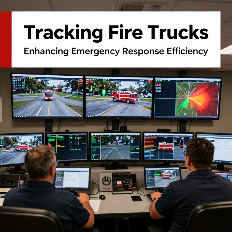
In the high-stakes world of emergency response, every second matters, and every decision can tilt the balance between containment and catastrophe. Tracking fire trucks in real time has evolved from a simple locator service to a cornerstone of intelligent, data-driven dispatch. Modern departments weave GPS-based visibility with a wider fiber of telematics and centralized dashboards, creating a dynamic picture of a fleet that is as agile as it is accountable. What once felt like a static queue of units now resembles a living map of capability, constraint, and opportunity. The result is not merely faster rides to the fire but smarter decision making that harmonizes proximity with readiness, weathering traffic snarls or evolving incident landscapes that can shift in minutes rather than hours.
At the heart of this transformation is a suite of technologies that work in concert. Each fire truck carries an integrated tracking module that continuously reports precise coordinates, speed, and heading. But the data does not stop there. Telematics systems extend beyond location to monitor engine temperatures, fuel levels, brake status, and even tire conditions. When these signals are fed into a dispatch center, they create a live profile of each unit: where it is, whether it is available, and whether it is fit for service. This visibility feeds the dispatcher’s screen as a mosaic of moving parts, each tile representing a unit with its own story—where it came from, how long it has been en route, and how soon it can be deployed again if needed. The practical upshot is a dispatch workflow that can respond with speed while balancing the broader picture of department readiness.
The core advantage of real-time tracking is intuitive: proximity remains a critical factor, but it is no longer the sole determinant. In dense urban settings, where streets can morph into rivers of traffic, the shortest route is not always the fastest or most reliable. A robust tracking system can reveal that a truck two blocks away might be caught in a light cycle or a bus lane, while a slightly further unit could take a corridor with fewer interactions and a smoother ride. This nuance becomes even more important during large-scale incidents that require parallel operations. When several calls arrive in quick succession, the ability to see not just where units are, but where they can move with the least friction, becomes a form of operational judgment that reduces overall response times. It is here that the discussion shifts from simple locating to predictive positioning, where data about past trips, current traffic patterns, and road conditions inform where a unit should be staged or held in reserve for the next escalation.
Recent research reinforces this shift toward smarter dispatch. A growing body of work emphasizes that models which incorporate stochastic driving times and their correlations yield sharper predictions of response times than those relying on fixed or purely deterministic estimates. In practical terms, this means planners can estimate how long it will take to reach a scene not just by distance, but by a probabilistic feeling for the traffic environment—how likely it is to slow down, where it might speed up, and how those conditions interact as conditions evolve. The implication is straightforward: ignoring the randomness and the interdependencies of travel times can produce meaningful performance losses. In some analyses, neglecting these factors has correlated with reductions in dispatch efficiency by more than twenty percent, a gap that translates into longer stays at risks during critical windows. A 2025 study published on a comprehensive platform highlights how accounting for the randomness of travel paths and their cross-dependencies improves both the speed and the reliability of emergency response decisions. This is not a subtle improvement; it redefines the baseline for what a well-run fleet can accomplish when the road itself is a variable rather than a fixed stage.
These insights feed back into the day-to-day operations of fire departments in concrete ways. For one, the integration of real-time location data with maintenance and fuel telemetry creates a continuous health check for the fleet. Automated alerts can flag a truck that is approaching a maintenance threshold or a resource that is running low on fuel mid-response, prompting contingency planning before a problem becomes a failure at the worst possible moment. This telematics-enabled readiness is not merely about avoiding breakdowns; it is about ensuring that the most effective tool for the job is always in a state to perform. In many departments, dashboards present an at-a-glance status for every active unit: where it is, where it is headed, what its current load factors are, and whether it is online and ready for deployment. When a new incident arises, the dispatcher can quickly filter units by proximity, readiness, and current workload, then cross-check with vehicle health data to confirm that the chosen asset has both the propulsion and the resilience required for the mission. In practice, this means fewer surprises and more predictable, dependable responses.
The efficiency gains from real-time tracking extend beyond a single incident. They cascade into planning, training, and even tactical design. With repeatable data on response paths, departments can visualize coverage zones and identify gaps in service that may not be evident from a map alone. Visualizations of call density, traffic patterns, and proposed rerouting strategies enable leaders to allocate resources with a precision that previously required educated guesswork. In areas with varied incident types, the data can inform decisions about vehicle mix and specialization. A recent framework for urban and rural contexts, drawn from a guide that emphasizes incident-type prioritization, suggests urban centers might lean toward aerial apparatus and agile ladder configurations, while rural districts benefit from rugged, off-road capable engines. In both cases, tracking systems provide the empirical backbone to justify choices and optimize the allocation of scarce assets.
Nevertheless, the promise of tracking is not a panacea. Real-world operation confronts several operational and cultural challenges. The most visible is the reliability and latency of data. A system that reports positions with delays or inaccuracies undermines trust and can degrade decision quality just when speed matters most. Ensuring robust communications, redundancy in data streams, and fault-tolerant dashboards is essential. Another challenge lies in governance and privacy. The same data that improves response times can raise concerns about how visibility into unit movements may be used or misused. Departments must cultivate clear policies about who can access data, how long it is retained, and for what purposes it may be shared beyond the immediate incident. These considerations are not objections to technology; they are prerequisites for responsible, sustainable adoption. Departments that succeed in this space often pair technical excellence with disciplined process design—standardized alerting thresholds, clear escalation paths, and routine drills that incorporate data-driven decision making into everyday practice. In short, the shift to tracking systems is as much about culture as code.
Integrated dispatch platforms, which fuse real-time location with status, maintenance, and crew availability, emerge as the most powerful expression of this shift. These platforms do not merely display where units are; they assemble a workflow where the data flow itself becomes an aid to action. When a call comes in, the system can present a ranked set of possible responses—not only by distance but by a composite metric that includes vehicle readiness, projected travel time with current conditions, and the probability of encountering congestion en route. The dispatch decision then becomes a calculation rather than a guess, a calculated risk that balances immediacy with reliability. The result is a more predictable response pattern across shifts and incidents, along with a clear audit trail that can be examined in training sessions or after-action reviews. Post-incident analyses, enriched by route histories and timing data, enable departments to refine both their tactical choices and their strategic footprint. Such analytics become a feedback loop that informs everything from the placement of staging areas to the cadence of drills that keep crews synchronized with evolving command strategies.
For readers seeking a broader perspective on how real-time data integration reshapes transportation and logistics beyond firefighting, consider the broader field of telematics-driven fleet management. The same principles that optimize a fire department’s response—visibility, predictive routing, and holistic asset health—are redefining efficiency in many other domains. A well-regarded synthesis on real-time fleet management emphasizes how central dashboards and data fusion can translate into tangible gains in reliability and speed across complex networks. In emergencies, those gains are amplified because the cost of delay is measured in lives as well as property. When a dispatcher can see, in a single pane, the exact status of every unit and the road conditions that affect them, the organizational agility becomes a public safety imperative rather than a logistical curiosity. This convergence of field data, centralized control, and responsive execution is the practical realization of what tracking promises to deliver: a firefighting fleet that is not just a collection of cars and engines, but a responsive, resilient system optimized for the unpredictable nature of emergencies.
To illustrate the continuity between tracking and command, it helps to recall a principle echoed across emergency-response disciplines: visibility is a force multiplier. When crews know their own status and can observe the broader fleet in real time, they operate with a higher degree of coordination and situational awareness. The command structure, in turn, benefits from a shared plasma of information that reduces ambiguity and accelerates decision cycles. The synergy is most evident when a complex incident unfolds—multiple fires, a mass casualty event, or a multi-agency response—where the ability to orchestrate units with both precision and flexibility becomes the decisive factor in outcomes. In such moments, the tracking-enabled system becomes the backbone of unified command, providing the common operational picture that aligns every moving part toward a coherent objective. It is a transformation that does not merely improve response times; it elevates the entire discipline of emergency services by turning data into decisive action.
Within this evolving landscape, the way departments select and deploy fire-truck models also adapts. A 2026 guide on incident-type prioritization emphasizes that regional conditions dictate differing configurations. Urban areas might prioritize equipment capable of rapid aerial operations and tight-space maneuverability, while rural regions may prioritize robustness, off-road capability, and endurance. Tracking systems feed directly into these decisions by offering empirical insight into how fleets perform under diverse conditions, how often certain units are diverted to non-primary tasks, and how maintenance profiles intersect with mission readiness. When a department can correlate equipment type with real-time utilization, it gains not only a more efficient dispatch process but a more thoughtful, data-driven asset management program. In this sense, tracking is not merely about locating units; it is about aligning the entire fleet with the realities of the terrain, the cadence of calls, and the evolving threats within a community.
One underappreciated facet of tracking is its impact on accountability and continuous improvement. Dispatch logs, response-time metrics, and route histories are increasingly auto-recorded, creating a robust dataset for after-action reviews. This is not about assigning blame but about learning what works and where friction arises. When teams can replay a call—from the moment the alarm sounds to the moment the unit clears the scene—they gain a powerful tool for refining tactics, adjusting coverage models, and validating investments in new capabilities. In practice, this translates to ongoing training that mirrors the real-world complexity of emergencies, with simulations informed by actual movement and performance data. The discipline of data-informed training helps ensure that crews are not merely following procedures but actively refining them in line with demonstrated patterns of behavior and outcomes. It is a shift from reactive learning to proactive optimization, supported by the transparent, traceable trail of a tracking-enabled operation.
None of these improvements would be sustainable without an emphasis on reliability and user-centered design. Real-time tracking systems must be designed with the end user in mind—the dispatcher who must balance speed with accuracy, the incident commander who must understand how the fleet is deployed in real time, and the engineers who keep the data pipelines resilient under stress. Users require interfaces that are not cluttered with superfluous information but instead highlight actionable insights: a clear indicator of available units, a straightforward read on each vehicle’s status, and intuitive controls for reassigning resources when circumstances change. The best systems also anticipate needs beyond the current call, offering proactive suggestions such as pre-positioning units in anticipated hot spots, triggering automated maintenance alerts, and signaling crew changes before fatigue becomes a factor. Integrating these features with existing command workflows demands thoughtful change management, robust training, and a culture that embraces data-driven decision making as a core professional competency. When done well, tracking becomes part of the operating rhythm rather than an afterthought tacked onto the end of a shift.
For those exploring the literature on this topic, the practical takeaway is clear: tracking systems in fire services are not a luxury but a utility that reshapes how people think about time, space, and risk. They translate raw geographic coordinates into meaningful, doors-wide decisions about where to send help, when to deploy it, and how to keep the fleet mission-ready while extending the reach of every dollar invested in public safety. As the field continues to mature, the next frontier may involve even more nuanced predictive models, greater integration with cross-agency data, and more sophisticated human-machine interfaces that further reduce cognitive load at moments of crisis. The journey from locating units to orchestrating a synchronized response is not a single leap but a gradual ascent, built on the steady accumulation of reliable data, thoughtful design, and an unwavering commitment to serve communities with speed, precision, and accountability.
In sum, can fire trucks be tracked? Yes. And the evidence suggests they should be tracked not merely as a convenience, but as a strategic capability—one that unlocks faster response, smarter resource use, and a disciplined approach to continuous improvement across the entire spectrum of emergency services. Real-time visibility, when tied to predictive routing, fleet health, and centralized command, creates a higher level of operational clarity. It becomes possible to anticipate where help is most needed, to stage assets in anticipation of demand, and to learn from every deployment in a way that makes communities safer and responders more effective. The data-driven dispatcher and the data-informed crew are no longer competing meanings of speed; they become two facets of a single, integrated practice that turns information into action when every second counts.
For readers who want to explore how real-time data integration extends beyond firefighting into broader logistics and fleet management, a comprehensive overview of telematics-driven real-time fleet management offers broader context on why such systems are becoming indispensable across sectors. See Real-Time Fleet Management: How Telematics is Transforming Logistics for a broader perspective on the principles that underlie these capabilities in other high-stakes environments. https://www.transportationdaily.com/real-time-fleet-management-telematics-logistics
Internal reference for further reading:
- For additional discussion on the operational challenges and solutions, consult the guidance on overcoming challenges in fire command systems. This resource delves into the practical steps departments take to ensure that tracking data translates into reliable, actionable command decisions on the ground. Overcoming challenges in fire command systems.
Internal link note: The above discussion aligns with the broader theme of how real-time tracking shapes governance, training, and daily decision making on the fireground. The linked resource offers a complementary look at command-system considerations that underpin effective tracking deployment and use.
Tracking Fire Trucks: Real-Time Visibility, Dynamic Dispatch, and the New Standard in Emergency Response
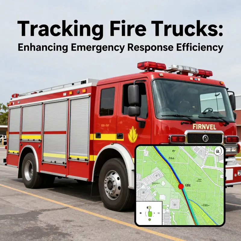
Real-time tracking has moved beyond a convenient feature to become a central operating principle for modern fire services. When a city lights up with sirens, the first metric that matters is not just who arrived first, but who arrives fastest with the right mix of capabilities. GPS and telematics turn that intuition into data you can act on. Fire departments increasingly deploy sensors that map every unit’s location, speed, and route. The result is a layered picture of the fleet’s current state, a dynamic map that informs every decision from dispatch to maintenance. In this world, complete visibility is not a luxury; it is the backbone of coordinated, effective response. The fire truck becomes more than a machine on wheels. It becomes a node in a living network that must respond to changing conditions with precision. The value of that network emerges most clearly in the small, almost invisible moments when a unit is held at a light or rerouted around a crash. Those moments accumulate into tangible improvements in response times and, crucially, in the safety and efficiency of the crew that carries out a life-saving mission.
The core of this capability lies in real-time data streams that merge location with a broad swath of vehicle health indicators. Modern tracking systems collect not only where a truck is but how fast it is moving and along which path. They can reveal if a unit is following a planned route or if it has deviated to navigate a heavy intersection, a scenario that might alter an ETA by seconds or minutes. The same stream can report engine temperature, fuel level, coolant status, brake wear, and even tire pressure. This correlation of mobility and condition creates a more accurate operational picture than location data alone. Dispatchers and fleet managers can anticipate needs. If a truck is low on fuel, the system can prompt a nearby unit with sufficient reserves to take the next assignment, ensuring the fire engine arrives with enough operational margins. In dense urban environments, where traffic can transform a four-minute drive into a six-minute journey, such predictive awareness becomes a practical force for good.
The implications of this visibility extend through the chain of command. When a call comes in, the dispatcher can instantly pull up a live map that shows which units are closest, which have the right apparatus for the incident type, and which are currently available. But real-time visibility also reveals constraints that are not obvious at the moment of dispatch. A unit might be closest on the street, yet its path could intersect with a known chokepoint ahead or a school zone during a staged evacuation. The ability to see these factors in real time enables a smarter choice—one that balances proximity, capability, and reliability of travel. The consequence is not simply faster response times; it is a more resilient deployment that reduces the likelihood of delays caused by predictable conditions such as peak-hour congestion or sudden road closures. This shift from proximity-only thinking to a more nuanced consideration of driving conditions marks a significant evolution in emergency response planning.
A growing body of research supports this shift. The 2025 studies published on ScienceDirect show that incorporating stochastic driving times and their correlations into dispatch models yields meaningful gains. When drivers contend with traffic fluctuations, incident delays, or roadwork, treating travel time as a fixed, deterministic value leads to suboptimal unit assignments. In contrast, models that recognize randomness and the interdependencies of routes can predict response times more accurately and allocate resources to where they will actually be when an incident occurs. The practical upshot is not merely theoretical improvement; departments report measurable efficiency gains and fewer instances of underused capacity, even when call volumes surge or incidents cluster in time. Ignoring variability in driving times, especially when those times are correlated across routes, can produce performance losses well over 20 percent. The real-world impact of this insight is not abstract; it translates into faster commutes for first responders and more reliable service for communities that depend on timely fire protection.
The integration of telematics deepens the operational picture beyond the wheel and the pedal. Telemetry provides a window into the engine, transmission, and fuel system—data that help managers see patterns that can prevent breakdowns mid-incident or during routine coverage shifts. A district that mines telematics data can identify recurring cause-and-effect relationships: a certain engine temperature pattern precedes a coolant leak, or a specific sensor reading anticipates air filter obstruction. Early detection reduces the risk of sudden failures that would strand a unit in the middle of a response or force a night shift into a last-minute bench. When a department can anticipate maintenance needs, it can schedule preventive work during off-peak hours, minimizing the probability of operational disruption during emergencies. In practice, this means longer vehicle life, fewer unplanned outages, and a more predictable readiness posture. It also means that when a responder arrives on scene, the apparatus they operate is not just in service but optimized for the incident—set up for the kind of dynamic work that modern fire scenes demand.
The conversational benefit of tracking is noticed as well in how crews experience daily operations. A driver who knows their speed, braking patterns, and idle time is nudged toward safer driving habits. The data can reveal risks that are not always evident in the moment—a hard brake in a crowded area, a stop at coffee or an unrelated call, or a route that routinely slows due to a stubborn traffic pattern. This level of accountability is not punitive by default. It becomes a learning tool that supports safer practices, more efficient route choices, and a shared commitment to the mission. When a system flags a sequence of events that suggests a potential safety risk, supervisors can intercede with targeted coaching, reinforcing expectations and offering corrective guidance before a pattern becomes ingrained. The result is a culture of continuous improvement that does not sacrifice mission readiness for the sake of oversight, but rather uses oversight to reinforce readiness.
The safety benefits extend beyond driver behavior. A curve speed warning system, studied in depth in 2025, demonstrates that adaptive speed feedback can reduce severe braking events, an issue that can lead to loss of vehicle control on curved road segments. Although the specific technology is only one part of a broader safety ecosystem, its impact within the tracking-enabled fleet is meaningful. When the system warns a driver about entering a sharp turn at an unsafe speed, the response is not merely to slow down; it is to adjust the approach by preemptively reducing speed, preparing the brakes, and coordinating with other responding units that may be approaching the same location. In the context of a live incident, where every second matters, even small reductions in abrupt braking can translate into safer navigation through complex scenes. The cumulative safety effect is a lighter incident footprint: fewer aggressive maneuvers, lower risk of rollovers or skid events, and a more controlled, predictable progression toward scene staging and rescue operations.
As tracking becomes more ubiquitous, the operational benefits also touch the less glamorous, but essential, aspects of the fire service. Fleet management does not exist in a vacuum; it depends on a steady rhythm of readiness, maintenance, and strategic resource placement. The visibility afforded by tracking makes it possible to align daily deployment with anticipated risk profiles. For example, urban areas with high incident density may prioritize certain apparatus types that excel in rapid extraction or high-angle rescue, while rural districts dealing with longer travel times and rougher terrain can place emphasis on off-road capable engines. This kind of model-informed readiness requires more than access to live locations; it requires an integrated data environment where dispatch, training, maintenance, and incident history feed a coherent strategy. Tracking systems operationalize that coherence by providing the empirical backbone for decisions that used to rely on intuition alone. In this sense, tracking becomes a force multiplier, not merely a logistical tool.
The practical implications for day-to-day operations are striking. Dispatchers learn to manage a portfolio of active units in which the ETA and the unit’s capability converge. If a fire in a congested corridor demands a ladder truck with a high reach and a water supply, the system can orchestrate a staged response that minimizes cross-traffic interference while ensuring the closest compatible unit is on the fastest route. In episodic terms, the difference might be as small as a few seconds, but those seconds accumulate with every call. In a busy city, they are the difference between early intervention and a growing fire, between a contained incident and a large-scale emergency. The reliability of the fleet improves too. With telematics, maintenance windows are not arbitrary but scheduled around the actual wear and predicted fatigue of components. A unit that has logged excessive idling or repeated hard accelerations can be flagged for maintenance before it becomes a hazard or a liability on the road. The result is a fleet that is not only available but resilient. That resilience matters when every apparatus must perform under stress, negotiate hazard, and coordinate with neighboring agencies that might not share a common radio protocol or vehicle interface.
This is where the conversation with the broader command and control landscape matters. Tracking, in its most capable form, integrates with the broader emergency management ecosystem. It informs pre-incident planning, real-time situational awareness, and post-incident analysis. A unit’s route, the time spent on the road, and its mechanical status are all data points that contribute to a richer understanding of performance. Researchers argue that this kind of data-driven view of operations helps departments identify where bottlenecks arise, how weather patterns influence travel times, and where infrastructure improvements might yield disproportionate gains in response efficiency. The approach is not merely about moving faster; it is about moving smarter, aligning the fleet with the realities of urban design, traffic patterns, incident types, and the public safety objectives of the department. In practice, that means a seamless connection between field officers, fleet supervisors, incident commanders, and maintenance staff, each drawing from the same real-time information stream to coordinate actions in the moment and to learn for the future.
This evolving practice does not happen in isolation. It sits within a continuum of command system challenges and advances. A useful way to think about it is as a feedback loop: tracking provides data about current conditions and historical performance, which informs decision-making and training, which in turn shapes how tracking is used in future responses. The loop becomes more effective when departments attend to the human factors involved—how captains interpret data on scene, how drivers trust and use the alerts, and how supervisory staff translate dashboards into tactical directives on the ground. The coherence between technology and practice is crucial. It is not enough to collect data; it must be interpreted in a way that supports the people who respond to calls, and it must be integrated with the department’s standard operating procedures and incident command workflows. When this alignment occurs, the tracking system does more than reduce response times; it elevates the entire discipline of emergency response planning.
The role of tracking in this ecosystem is not to eliminate uncertainty but to reduce its impact. Real-time visibility provides a more reliable forecast of arrival times under a range of plausible conditions. It can reveal which assignments are at risk of delay and allow for proactive mitigation, such as repositioning resources during a busy shift or rerouting around an emerging incident that would otherwise cause a cascade of delays. In this way, tracking informs both tactical and strategic decisions. It is a tool that supports the right unit arriving at the right place at the right time, with the right equipment, and with a crew prepared for the specifics of the scene. That is the heart of the new standard in emergency response: a system that translates data into action with speed, precision, and accountability.
For readers who want to explore how the challenges of command systems intersect with field data, the linked discussion on overcoming challenges in fire command systems offers deeper context. The integration of real-time tracking with command routines is a practical example of how theory translates into practice on the ground. This chapter does not close with a single takeaway but with a collaborative invitation: to view tracking not as a standalone feature but as an integrated capability that links dispatch. The stationhouse, the street, and the incident scene together create a continuous loop of information. When each part of that loop operates with clarity and trust, the entire system becomes capable of delivering faster, safer, and more reliable emergency responses to the communities it serves.
External resource for further technical reading: NIST curve speed warning study.
Final thoughts
Tracking fire trucks is not just a technological advancement; it’s a fundamental shift in how emergency services operate. By leveraging GPS and tracking systems, fire departments can enhance their response capabilities, ensuring that help arrives swiftly when seconds count. Enthusiasts and professionals alike can appreciate the critical role that technology plays in evolving firefighting practices. Embracing these innovations will lead to not only faster responses but also a more efficient allocation of resources, ultimately saving more lives.